aerial photography

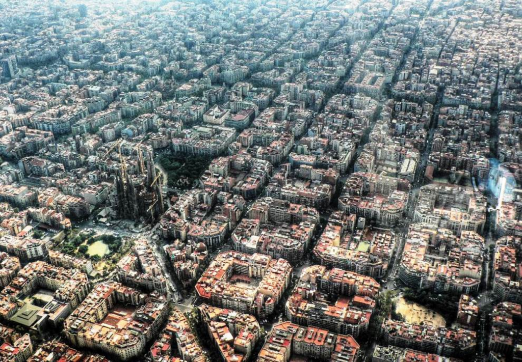
Looking Down on Barcelona

An aerial photograph of Barcelona’s Eixample district stopped me in my tracks. At first glance, all I could see was astonishing density—thousands of people living in an orderly grid that stretches to the horizon. Yet the longer I studied the image, the more questions it raised. Why can I find endless aerial photographs of Eixample, but almost no street-level views? What does life actually feel like inside those blocks and hidden courtyards? And what does this remarkable city reveal about our own assumptions regarding space, community, and how human beings should live together?

Why Build a Fortress Like This?

Most people look at a photograph like this and think, How pretty. I look at it and think, Why? Fort Bourtange is a stunning star-shaped fortress in the Netherlands, but what fascinates me isn’t its appearance. It’s the sheer amount of labour, planning and expense that went into building it in the late sixteenth century. What sort of world made such a massive defensive project seem necessary? And what would it have been like to actually live inside its walls? One aerial photograph opens the door to questions about history, war, economics, daily life—and why setting matters so much to fiction writers.

The City With No Spare Inch

An entire capital city packed onto a single tiny island in the middle of the Indian Ocean, with barely an inch to spare. Looking at aerial photos of Malé, the capital of the Maldives, it’s impossible not to wonder about the fragility of cities, civilization, and the strange places human beings insist upon calling home.

Shopping Basket
Scroll to Top